Day 1: Exmouth → Budleigh Salterton
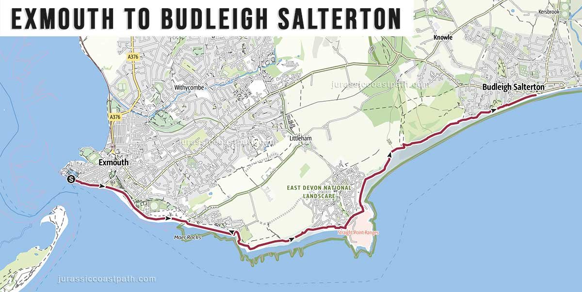
Distance: 5.7 miles / 9.2 km
Time: 2.5–3.5 hours
Short coastal section with estuary views at the start and moderate elevation.
Day 2: Budleigh Salterton → Sidmouth
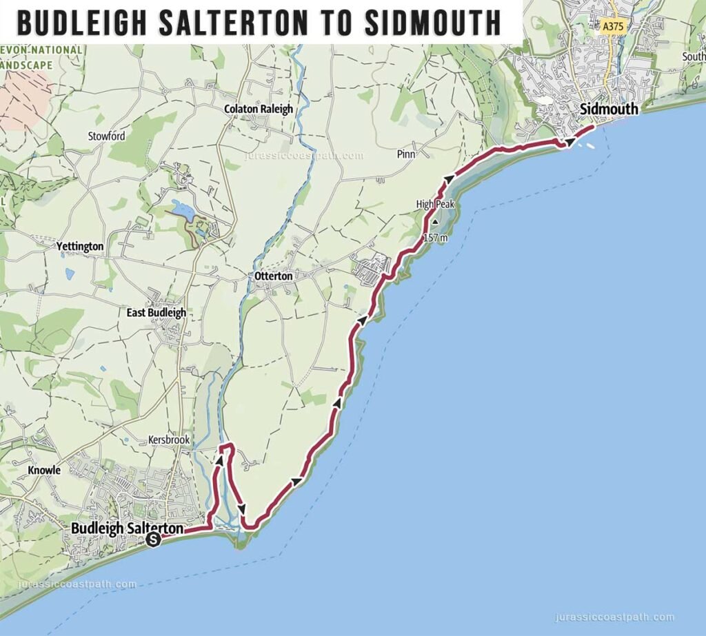
Distance: 7 miles / 11.3 km
Time: 4–5 hours
Longer section with steady climbs and quieter stretches of coastline.
Day 3: Sidmouth → Beer
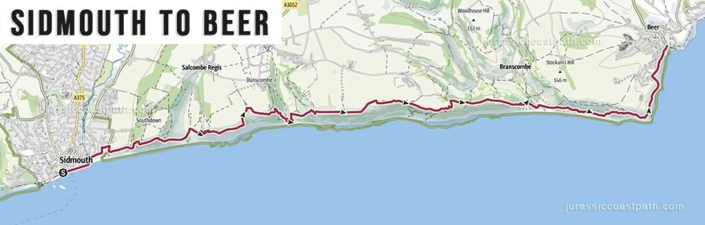
Distance: 8.9 miles / 14.3 km
Time: 4.45–5.5 hours
Cliff-heavy section with steep ascents and descents.
Day 4: Beer → Lyme Regis
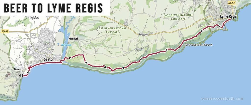
Distance: 9.1 miles / 14.6 km
Time: 4.5–5.5 hours
A longer section with varied terrain, ending at Lyme Regis.
Dorset Section
The Dorset section includes a mix of coastal walking, inland diversions and some of the most well-known landmarks along the Jurassic Coast.
Day 5: Lyme Regis → Seatown
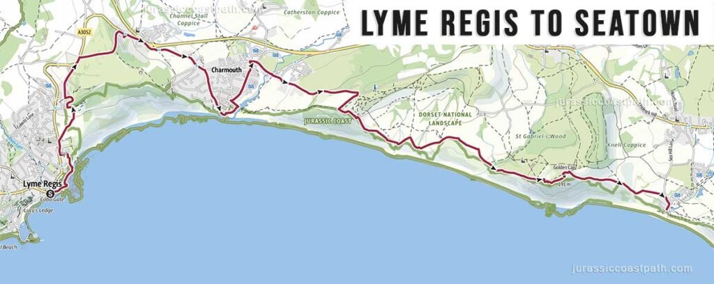
Distance: 8.1 miles / 13 km
Time: 4-5 hours
Short section beneath the cliffs of Golden Cap towards West Bay.
Day 6: Seatown → Abbotsbury
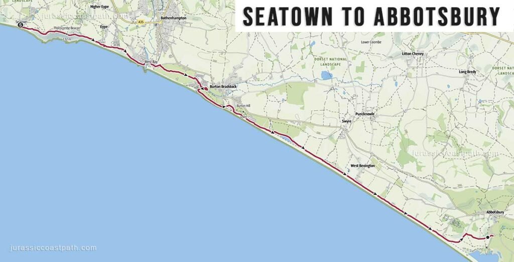
Distance: 12.1 miles / 19.5 km
Time: 5.5-6 hours
Mixed terrain with coastal and inland sections along the Fleet Lagoon.
Day 7: Abbotsbury → Weymouth (Ferrymans Way)
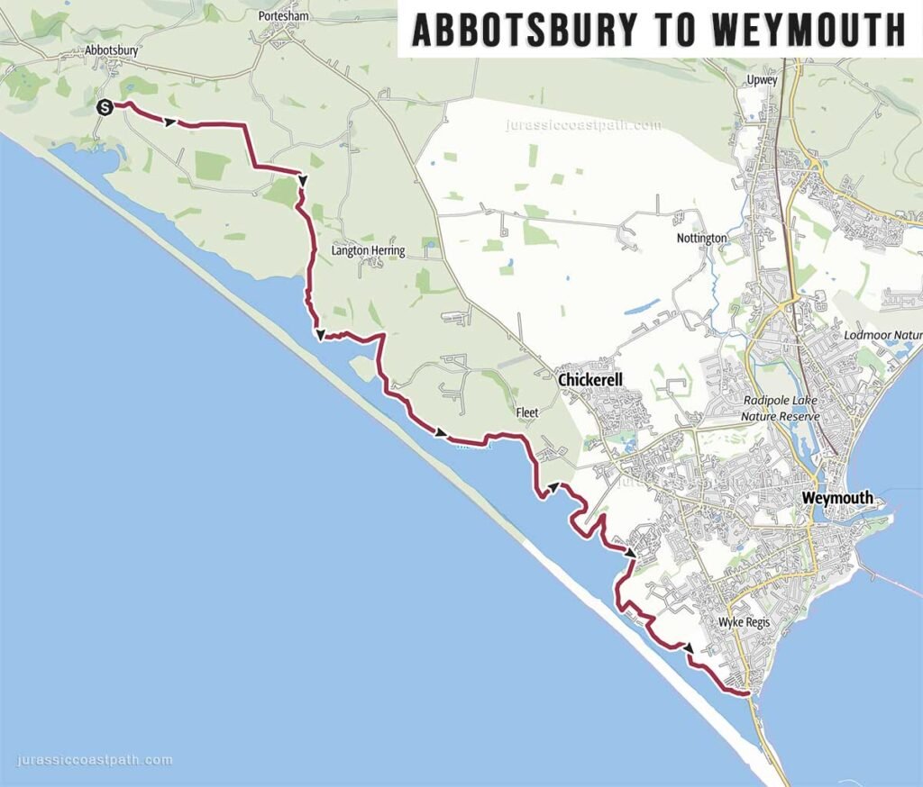
Distance: 10.8 miles / 17.4 km
Time: 4.5–5 hours
Longer section following Chesil Beach and the Fleet towards Weymouth.
Day 8: Weymouth → Osmington Mills

Distance: 8.1 miles / 13 km
Time: 3.5–4 hours
Cliff-top walking with steady climbs and coastal views.
Day 9: Osmington Mills → Lulworth Cove
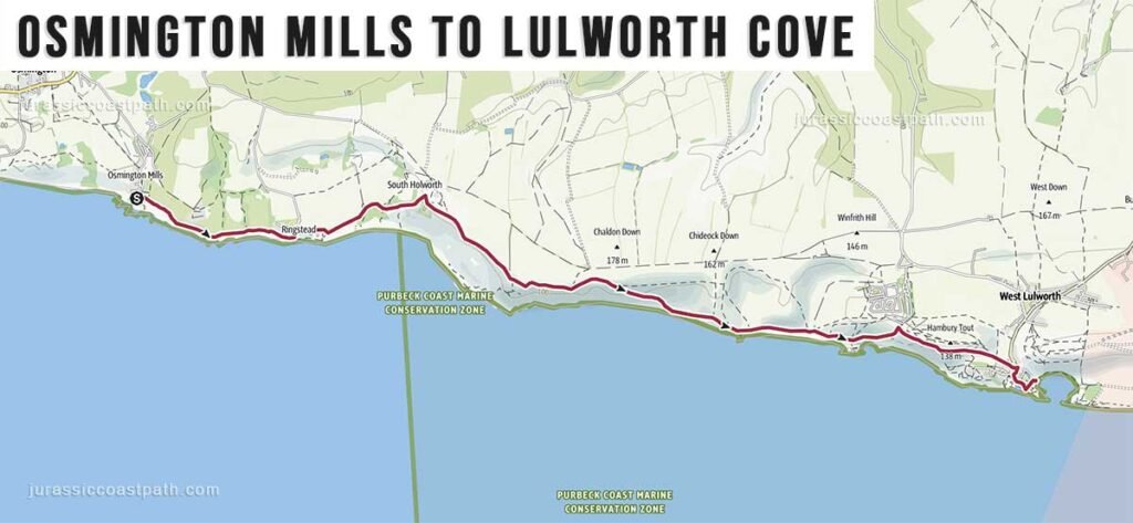
Distance: 6.4 miles / 10.3 km
Time: 3.5–4 hours
Includes White Nothe and varied cliff terrain.
Day 10: Lulworth Cove → Kimmeridge
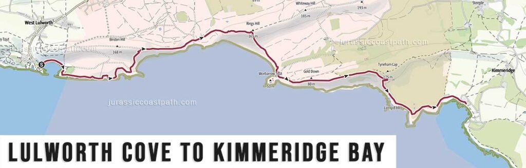
Distance: 6.9 miles / 11.1 km
Time: 4–4.5 hours
One of the more demanding sections with steep climbs near Durdle Door.
Day 11: Kimmeridge → Worth Matravers
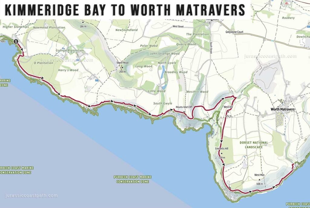
Distance: 7.3 miles / 11.7 km
Time: 4–4.5 hours
Cliff-top walking across open Purbeck landscape.
Day 12: Worth Matravers → Swanage
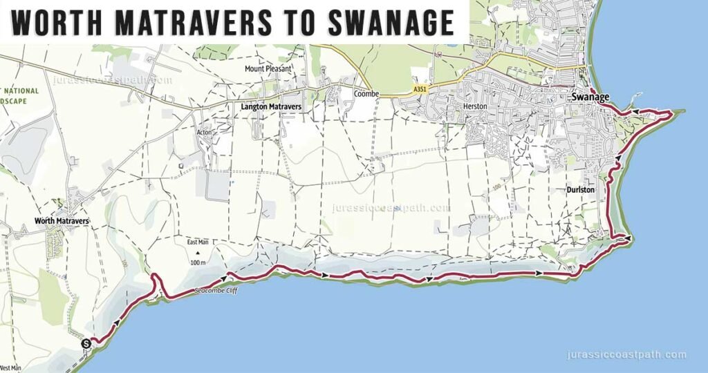
Distance: 6.3 miles / 10.1 km
Time: 3.5–4 hours
Includes coastal ridges and approaches to Swanage.
Day 13: Swanage → Studland (Sandbanks Ferry)
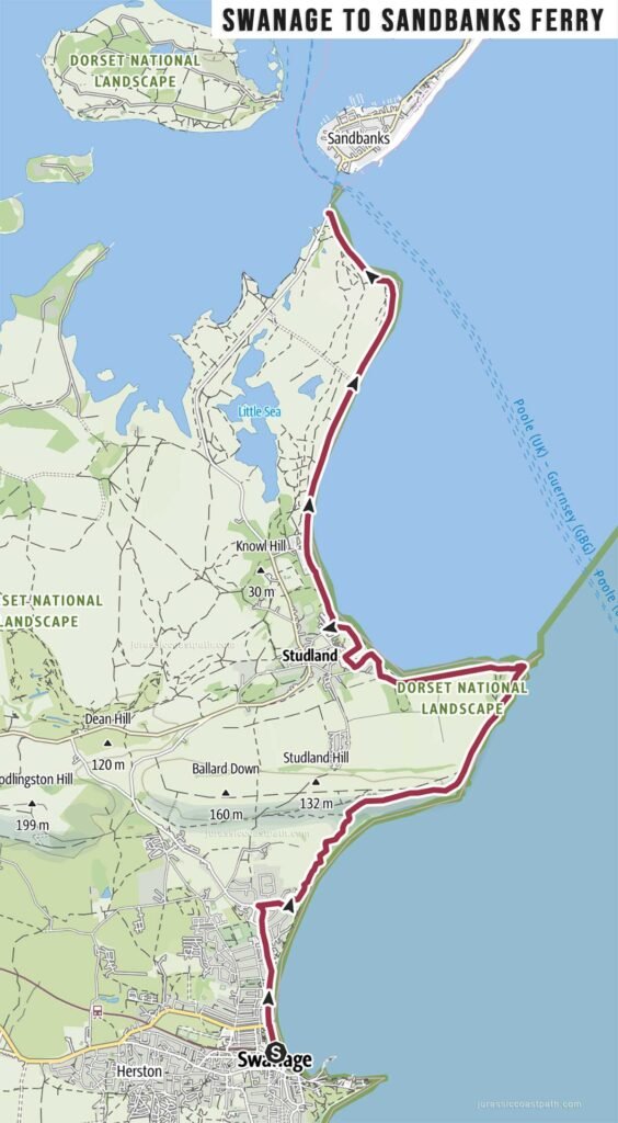
Distance: 7.5 miles / 12.1 km
Time: 3–4 hours
Final section with easier terrain leading to Studland Bay.